
Section 4 is 76.5 miles long and runs from MacDonald Pass to Anaconda. July 16th - 21st.
Day 23, 9.8 miles to camp at marker 370.7
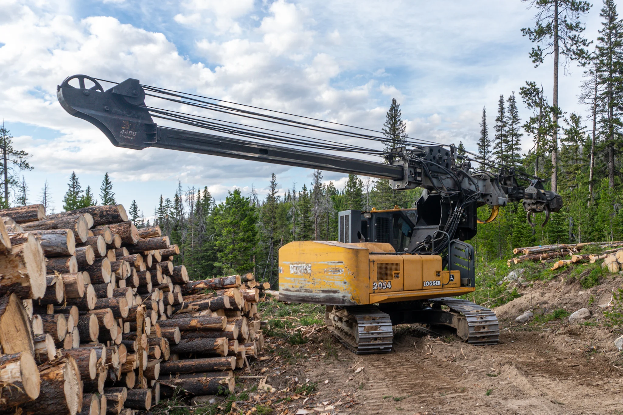
We slept in at the comfy Hilton with it's luxurious beds and then went to their affordable $10 breakfast that included made-to-order omelettes and freshly baked muffins. This delicious breakfast coupled with free guest laundry, a hot tub, late check out, and the fact I packed out six muffins for my breakfasts over the next stretch, made the extra price of the hotel totally worth it. Budget Inn would have been cheaper but the convenience of getting all these bonuses under one roof was fantastic. I went to the local outfitters to get new sunglasses (lost my second pair at the lookout tower) and a new freeze dried meal. Backpackers Pantry Pad Thai is the best ever. Then I took some photos around town as I walked to Van's grocery to get my food resupply taken care of. I ran into the mountain bikers from the last section and chatted with them for a bit. Next I went to grab lunch at Fireside Coffee and then hit the road. I scored a hitch in less than a minute from am old timer named Dan who said he hitched all over the world in the 60s and that Rio de Janeiro was his favorite place. I got a decent bit of miles covered for not starting until 5PM and along the way I passed by a logging operation. I felt like a little kid staring in awe at the big machines as they ripped trees out of the ground and de-branched them. I trekked a few more miles and found a field of pines barely big enough to support my house.
Cool art on Helena's walking mall.
Helena also had neat architecture.
Logging toys.
Day 24, 22 miles to camp at marker 392.7
I got some great sleep and hit the trail nice and early after enjoying some of my Hilton muffins for brekkie. The day began with a nice long road walk along some dirt roadways with a few quaint little cabins in the side. It went back to regular trail and then the last water source for a bit was a murky stagnant pond. Oh well. Luckily I had some Mio flavoring to take out the stank. Then I had a PUD followed by a climb up Thunderbolt Mountain which has a viewpoint up top but the dreary and cloudy day rendered the view mediocre. I continued on and got to Cottonwood Lake which was more of a pond surrounded by a field or possibly an old lake bed. I hiked another mile or so and set camp while realizing that for the second time on this hike, I went an entire day without seeing any other humans.
Happy post.
The CDT Coalition does great work and maintains a lot of trail, but they could use a lesson on attaching roofs.
Day 25, 22.7 miles to camp along the Anaconda alternate route.
I made quick work of the short incline up to a ridge and then I soon arrived at the 400 mile mark. There wasn't a marker, which makes sense because there are so many alternate routes and so many flip-flop hikers that nobody is really on the same mile, so I decided to make one. I also took a food break at this milestone, finishing off my pepperoni and cheese wraps with a side of Fritos. The trail soon emptied out onto a high field with a great view of the valley that Anaconda rests in and the mountains behind it. Further on I could see an absolutely massive tower next to the town that looked to be as tall as the surrounding mountains. After some dropping down in elevation, I hit the road to the Anaconda cut off, only 27 miles of road walking to get there. I stopped for dinner near the Cottonwood Creek but some map comments said it was heavily contaminated so I decided to boil water and then filter it. I wasn't going to hike another 10 miles without hydrating! The road departs the creekside for a few miles and I found a dirt trail leading more straight so I elected to try it out. It fizzled out but I was again determined to not backtrack so I pushed on. The road dipped down to a low gulley lined with trees but I remained up on a golden field of wheat with views of the sun bursting through the clouds and filling the valley. After hopping a fence I found the remains of an old cabin and then dropped back down to rejoin the road. A few miles later I found another group of logs, arranged in a corner of what used to be another cabin. It had strong pines nearby and no sign of burned or dead trees so I decided to camp there for the night. I thought 20 miles of dirt road walking would be easy to tackle tomorrow.
🎵and I would walk four hundred miles🎵

Powering the Mountains.
The road takes the low road and I took the high road.
My view was better than the road's view.
First cabin find of the day.
Second cabin find of the day + my house.
Day 26, 20.5 miles to Washoe Park in Anaconda, MT.
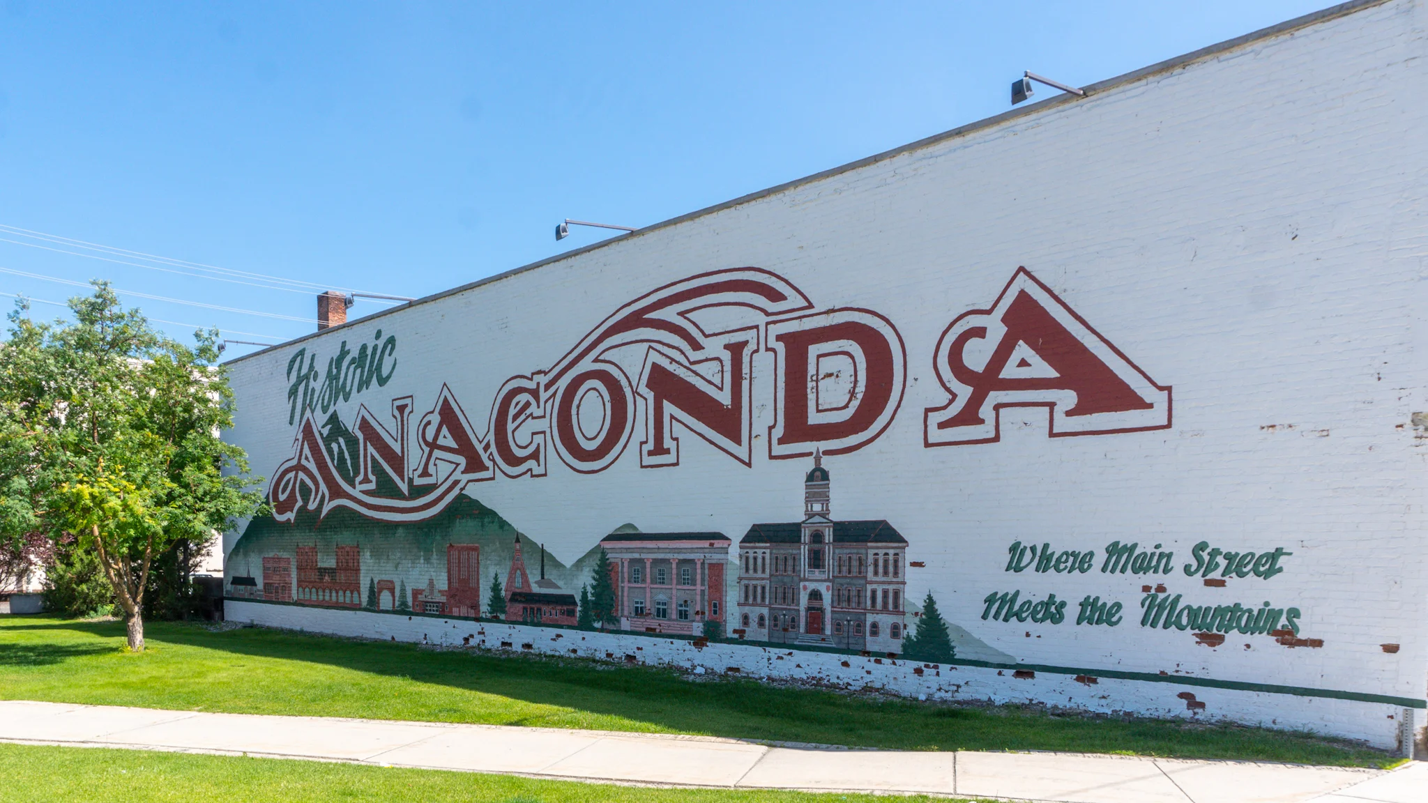
I made a point to get on the trail early and try to beat the heat for this long and dry road walk. It was fantastic for the first eight or nine miles as I went passed some cool rock formations and a sprawling farm littered with RVs, old tractors, and various logging projects. I again followed some comments on my map that said a ranch let's hikers camp and fill up water so I found a spigot and did the latter. But I wasn't going to camp at 11am. I stopped at Warm Springs Wildlife Management Area to have lunch and do some stretching and then was off the the painful road walk on paved highway, with no shoulder, no shade, for nine miles. It was brutal. The final stretch goes along Highway 1 and next to a massive mountain of black slag from the old smelter plant. I later learned that the tower is the tallest free standing brick structure in the world and that the slag mountain is a EPA superfund site that they plan to cap off. In town, I picked up my old hammock from the post office and ate dinner at Donovan's Bar. I stopped in an embroidery shop to see if I could use their sewing machines to make some modifications to my hammock and they were happy to oblige the next day. I walked to Washoe Park where the town maintains a hiker hut equipped with a table, electricity, and free WiFi. There was also the Art in the Park festival going on all weekend with food trucks and live music so I knew that this was going to be a great spot to take a 0-day or two.
Artifacts at the abandoned cabin.
Can you see the face?
Breaking Bad mobile meth lab?
At 585ft tall, the Anaconda Smelting Tower is tallest free standing brick structure in the world and dominated the landscape. Also pictured in front is the massive, black slag mound that covers 130 acres.
Day 27, 0-Day in Anaconda.
I had a cold sleep since it was decided to leave a window open to reduce condensation so I stayed snuggled in my quilt and edit some photos in the morning. Another hiker, Toolbox, found that the American Legion food tent opened early for breakfast and $6 got you two pancakes, choice of meat, eggs, and coffee so I went there. I borrowed the hut's loaner bicycle to ride to town to The Upper Thread embroidery shop where Suzie showed me how to use a sewing machine and was super helpful. My old hammock has two layers so you can slip a sleeping pad in between but it always shifts to weird angles and I recently concluded that it's easier to lay it on the top layer. My old hammock’s bottom layer ripped on my AT hike and the manufacturer sent me a replacement which I have been using. Since I no longer want both layers I cut the ripped layer off to save weight and volume in my pack and while I was at it, I removed the zipper from one side. Check the video below, it may help visualize what I'm rambling about. Overall, removing the outer layer and half of the zipper saved me half a pound! I thanked Suzie then stopped by a car show on my way back to the hut and then handed the loaner bike off to Robert who also needed to make some sewing repairs at the shop. I spent the rest of the day frequenting the festival's food trucks, taking a nap in my modded hammock, and hanging out with more hikers as they arrived to town. After the music ended we made a campfire in the nearby firepit and relaxed for the night.
I spent all $50 of my cash at food trucks.
Day 28, 10.8 mile slackpack back to Anaconda, MT.
The level of suck that was the long roadwalk was still fresh in our minds so we decided to slackpack the remainder of the roadwalk along the Anaconda alternate. Cargo, Swamp, Willy, and myself had a ride down Highway 1 just fall into our laps. Two trail angels just happen to stop by the hiker hut and ask if anyone needed a lift so we rode almost 11 miles down the highway, got dropped off, and crushed the miles back to town. This way, we have about 12 miles tomorrow morning to get to Storm Lake before the afternoon heat tips the thermometers at a blistering 90F. The lake is a great local swimming hole and allegedly has some cliff jumping. Anyway, this stretch of road walk was amazingly uneventful. Sunday night I met up with yet another trail angel, Josh, who cooked up kebabs and burgers for Simba, Cargo, myself, and a new hiker named Dave. Josh is quitting his long time career and can't wait to start hiking and fishing around the area he grew up in but traveled for work too much to enjoy.
Slackpacking towards the smelting tower.
Most interesting part of the roadwalk.
Josh elected to have hikers sign a wall in his garage instead of a guest book.