

Section D is 112.5 miles long and runs from the I-15 bridge at Cajon Pass and drops down to the town of Aqua Dulce. May 29th - June 3rd.
Day 23, 21.3 miles to camp at 356.7.
With a McDonalds just ahead at Cajon Pass we needed no extra motivation to fly down the final 6.5 miles in just two hours. We got breakfast, second breakfast, and lunch there while charging batteries, and ordering new shoes for me and a new backpack frame for Nhandi. Afterwards, we crossed under the I-15 highway and were officially in Section D, which welcomed us with a creepy and uninviting car graveyard. From there, we snaked over and under some train tracks, took a siesta in some shade, and then went up a huge climb to camp at Gobblers Knob. It was a full moon and we cowboy camped because I planned to get up early and night hike further up the mountain to watch the sunrise over Cajon Pass.

Section D is off to a welcoming start...

Geometry is fun.

Nhandi looking like a superhero.

Guardian of the water cache!

Tangled mess of railroad tracks and highways at Cajon Pass.
Day 24, 12.6 miles to Wrightwood.
I can't ever sleep well when I'm getting up early the next morning. I wish I could force my brain to trust my alarm. So at 230am I was happy to stop tossing and turning and just hit the trail for a five mile long night hike to a superb ridge to watch the sunrise. I set a timelapse and am quite satisfied with how it turned out. We hiked the rest of the stretch to Inspiration Point passing a ski resort, some fenced ponds, a baby rattlesnake, and some great views of Mount Baden-Powell. We caught a hitch to Wrightwood where I exchanged my Darn Tough socks (I wore FIVE holes through them already) and in the process we met a trail angel, Cindy, who convinced us to stay with her and her husband, Jeff. We were planning to pop into town for a food resupply and leave but free showers, laundry, and bed was too enticing after about four hours of sleep. They even let us borrow their bicycles to ride back to town to grab dinner, beers, and finish up town errands.

Baby rattlesnake.

First hitch in the back of a pickup. Destination on window sticker.
Day 25, 14.6 miles to Little Jimmy Camp.
We bummed around Cindy and Jeff's place for a bit then walked down to town to get a proper brekkie and get some extra snacks for the next section. I edited the sunrise timelapse and hung out with some hikers at Jensen's Market as they began getting day beers. I knew the town vortex was closing in so we hitched back to the trail. It was a pleasant short section for a few miles and then the climb up Mount Baden-Powell began; 2800 feet over 40 switchbacks to the summit. When Nhandi caught up, we put on some tunes and had a little dance party up top. From there it was a long descent along a windy ridgeline to a campsite with tons of tent spots and it even had picnic tables. Every once in awhile it is nice to eat a meal while seated like a civilized human instead of hunched over in the dirt!
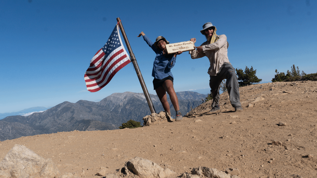
Baden-Powell Summit.

I love how the clouds hang in the valley below.
Day 26, 23.9 miles to Sulphur Springs Campsite.
June 1st. We hit the trail around 7, as is becoming tradition, and blasted a few miles down to the Yellow Mountain Frog detour. For years now, the PCT has been closed between miles 390.2 and 394 since an endangered frog resides there. The detour is a road walk along highway 2, then a cut through Buckhorn Campgrounds, and connects back along the Burkhart Trail. We lucked out and hit a trail magic less than half a mile in on the road walk; fresh fruit, sandwich fixings, chips, and beer! The shade kept shifting so we moved the table a couple times. Nhandi said she was too cold in the shade, too hot in the sun, and needed to just leave an arm out. I said sea lions do that with their flipper to warm up...and BOOM we have a new trail name. Nhandi is henceforth known as Sea Lion. After a moderate amount of brewskis, we continued down the road walk only to find the magic had relocated so we hit it again! From there we linked up with a new squad (Moose, Midge, Squirrel, Rabbit, Outback, and Blueberry) and continued on the Sulphur Springs Campsite where we made a nice big campfire and drank whiskey. It was a good day.

Thanks to Janelle for the TWO trail magics in the same day!

The redness of Scarlett Bugler's is always popping.

Sulphur Springs was a bit off trail at a confusing junction, so Midge made a sign for the rest of the group behind us.
Day 27, 23.7 miles to Messenger Flats Campsite.
We galloped out of the equestrian campsite and began another climb up Pacifico Mountain to a water spring which was infested with friendly bees. Two landed on my knee to lick up my salty sweat as I refilled my water bags. Down in Tie Canyon, at the Mill Creek Fire Station, everyone filled water and took a lunch break. Sea Lion left to get a head start on the upcoming ascent before the afternoon heat struck and not five minutes later, another trail magic arrived. Shade Baby and Tim hiked the PCT last year but quit around mile 2000 because there were so many fire closures that the trail became a giant road walk. They brought fruit and beers. I packed two out so Sea Lion and I could enjoy some suds during siesta. After our break, I ran up Mount Gleason but my feet were hurting and my energy drained to empty. I had a snack and then slowly wobbled my way down to Messenger Flats where I ate a huge dinner of mashed potatoes + ramen + tuna + olive oil. Gimme those calories!

Thanks Shade Baby and Tim! The beers were deee-licious.

Before the switchbacks down to Messenger Flats.
Day 28, 24.1 miles to Hiker Heaven at Aqua Dulce.
Our luck had run out and the usual 100+ degree heat had returned to the desert, so we got an early start at 6am to continue the drop. We got to the North Fork Ranger Station where Ranger Ron keeps a water cache and sells snacks and ice cream. So obviously we each carried a Klondike bar as we set back out into the heat. The rest of the descent was beautiful as we walked down some ridges while looking at massive red rocks in the distance. The next water source was at a KOA campground which was the most perfect siesta yet. There was pizza delivery, ice cream, showers, shade, picnic tables, and a swimming pool. We relaxed there for about five hours to wait out the heat then pushed the final ten miles to Aqua Dulce. After braving a long and dark tunnel under Highway 14 we were in the otherwordly Vasquez Rocks Park, famous for it's crazy rock formations that have been the backdrop in countless films. It was getting dark and we got to town at 9pm, just in time to cram into the last shuttle to Hiker Heaven. Sea Lion and I backtracked the next day to spend some quality time at the rocks.

Check tarantula off the list! I want to see a scorpion next.

Vasquez Rocks Park has crazy rocks.

Truck full of hikers and packs. Thanks for the lift Fred!

I'm the speck up on top of this famous rock. The video below shows how I got there.