
Section 8 is 110.4 miles long and runs from Lima, MT to Old Faithful Village in Yellowstone National Park. August 5th - 9th.
Day 43, 10.7 miles to Little Table Mountain.
I returned to Jan's Cafe for breakfast and to charge some of my devices then went to the post office to pick up my food drop. I sorted it at the little gazebo in the park where I camped and then got ready to catch the 11:30 shuttle from the motel to the trailhead. I then decided to hang around town for a bit longer and catch the 5pm shuttle. This would give me time to work on the blog and deal with some HVAC issues starting to act up at my house back in Baltimore. I wasn't the only one hoping to catch this shuttle, which is really just a pickup truck with a cap on the back. Fourteen, yes 14, hikers and packs crammed into the truck and we learned it was just one shy of the all time record. It was also funny to see 14 hikers getting vomited out onto the side of the highway. We soon thinned out and one big trail family set up camp after a tiny four miles. They were treated to an absolutely spectacular sunset and I wish I could have joined them but I knew I was still on a time crunch to make it to Rawlins. From there I will hitch to Salt Lake City and then catch a flight back home for my good friend Ellen’s bachelorette party, my cousin Hannah’s wedding, and to rendezvous with my fiancée. Tailspin, Rafiki, Taxi and I continued up Little Table Mountain and they began to drop off and call it a day while I hiked on. At the summit I caught the end of the sunset and made it another mile or two before setting camp.
How are we going to fit 14 packs and 14 hikers?
This flower looks like it would be a James Bond villain (Nodding Plumeless Thistle)
Oh yeah!
Day 44, 29 Miles to marker 889.5
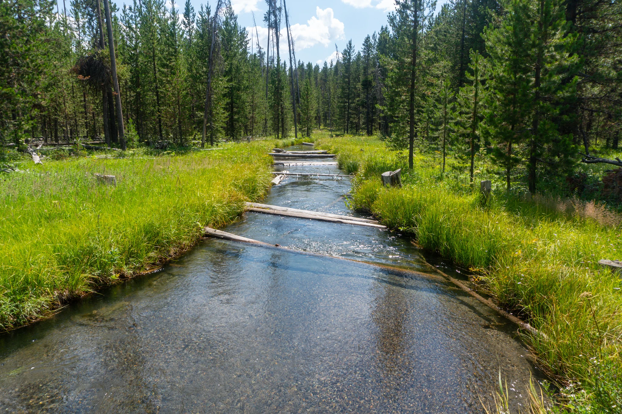
I was up pretty early and as I was packing up, I noticed pinecones kept dropping near me at a way higher than natural rate. I then noticed a little punk squirrel up in the tree who was trying to bomb me with pinecones! He only hit me in the leg once as I was sitting in my hammock and I hurled insults at him every time he missed. I would have tried throwing some back at him but was very high up in the trees. After an uneventful 5.5 miles, Robert caught up to me and we hiked together for a bit and chatted about other trails, towns we lived in, and life in general. Nature called so I peeled off trail as he hiked ahead. I next arrived at a beautiful spring surrounded by wildflowers and soon afterwards the Guthooks red line of the trail parted ways with the obvious treaded path. I blasted a few more miles to Chang Creek where I iced my feet in the water and did some stretching. After another few miles I arrived at the last water for a 20 mile haul so I cooked dinner there and cameled up. Guthooks again did not match the trail but some notes said to stay on the ridge so I hiked into the night. Table Mountain blocked another fantastic sunset on my way up a climb and I was able to stay on track thanks to the new trail markers being reflective and bouncing back my headlamp’s light. As the wind started to pick up and I lost the trail a couple times, I decided to cut my 30-mile day short and find camp. One small cluster of pine trees had a perfect hammock spot and was just enough downhill to block the wind.
More wildflowers.
What?
Here is an explanation of what the sheep experiment is all about.
Table Mountain.
Day 45, 27.4 miles to the Island Park Alternate.
My hammock spot was cozy, shielded me from the wind, and emerging from it was beautiful, like walking out into a new world. It was dark when I got up on the ridge and night hiked for a bit so this was all new to me. Before a big drop down off of the ridge a NOBO hiker said that there is a trail angel up ahead which added some pep to my step. I went barreling down the hill and could see a shade tarp rigged up to the side of an SUV! I met Slim, a hopeful hiker who got injured in New Mexico but decided not to let that end his adventure. He then went on an epic cross country road trip on mostly dirt roads and is now throwing some trail magic before returning home. I hung out with him for about an hour and then continued on towards the Island Park Alternate. It was nice and sunny all day but soon after crossing onto the alt route, a quick downpour kicked up and soaked me. I was less than enthused about it but my mood quickly changed as I hiked up the gorgeous valley surrounding Roaring Creek. I saw the most evil looking radar perched on top of Sawtell Mountain and then saw a big rainbow as I began the walk down the access road. I caught up to Robert and we night hiked down the gravel road for a bit until finding some good camp spots. We planned to get breakfast in town the next morning after a short four mile hike.
Can't beat that morning light.

Slim, thanks for the beer, soda, and Gatorade!
Roaring Creek valley.

Day 46, 23.1 miles to camp at marker 977.7 and a pit stop in Island Park.
I was surprised to wake up and find that Robert had already packed up and left without me hearing a sound. I followed suit and after passing a few big mansions, I arrived “in town.” Robert and Fidget were at a realty office with a coffee shop inside that was hiker-friendly. They let us charge our stuff and chill on the porch as we discovered that there was no breakfast-serving restaurants in town. After topping off my phone battery I went to Subway to buy a footlong for brunch and a footlong to pack out on trail. I stopped at Robin's Roost on my way out of town to grab the rest of my food supply and was on my way. Before crossing the Henry's Fork River I was distracted by an ice cream shack which would be perfect as I set out in the afternoon heat. I got a double scoop of huckleberry cheesecake and began hiking down another long roadwalk. I called my fiancée and my moms as I still had service in the town's cell coverage. Service eventually died out right as I arrived at Moose Creek which was perfect for a quick cold swim and a water fill up. I then blasted the next seven miles to Latham Spring which was the last water for yet another 20 mile stretch until Summit Lake in Yellowstone National Park. The spring was a very slow trickle and as I was collecting water, a group I had been leapfrogging with caught up; Rattles, Nomad, Aladdin, and Peabody. I hiked with them for the rest of the day which involved more road walking down roads that were decreed to be not driveable anymore. So every 20-30 yards they dug huge berms to make it completely impassable for any vehicle. This frequent obstacle seemed like complete overkill and became annoying to hike around. We had planned to make it to the border of Yellowstone National Park but a strong rain swooped in so we set camp a few miles short.
That evil radar keeping an eye on the town below.
It is hard to miss the side trail to Latham Spring!
Day 47, 20.9 miles to Old Faithful Village.
We were up early and glad to find it was no longer raining. I was again glad to be hammocking on this trail because only my tarp was wet, no dealing with soggy tent floors or damp backpacks that were sitting on the ground. We all stopped at the Wyoming border for photos and snacks and were happy to have crossed off another state. After a few more miles we arrived at Summit Lake and just before hand I slipped on a log, kept my footing by quickly catching my momentum with a trekking pole, but bent the hell out of it. It was at an unusable angle so I gently tried to bend it back but it snapped at a joint. I spent most of our water break MacGuyver’ing it back together. Next we soon passed a geyser field that had a few bubbly springs and reeked of sulfur. After a big drop down into a valley we entered the tourist zone which had an immediate uptick in day walkers heading to Mystic Falls. We got to the crowded boardwalks in the Old Faithful Village area and began joining the masses in taking photos of all of the unique geothermal features. Geysers were spewing and bubbling and we talked about taking a zero day the next day to explore the park. We were bummed to find out the only campsite was three miles south and we did not want to then backtrack three miles to the breakfast buffet. Ask instead we hitched to Grants Village which has some “hiker & biker” campsites reserved for people like us. We ate dinner at the Grant's restaurant, walked to camp, checked in, and hung out with our neighbors for a little bit before bed.
Typical Yellowstone weather.
Two states down! Three to go (Wyoming, Colorado, New Mexico)
Off the beaten path geyser field.