

Day 3, 9.6 miles to Necklace Valley Trailhead.
I will always wonder how I managed to sleep so terribly while being so completely exhausted. But at least I took some nice star photos while I was up. I knew today’s stretch was all flat and downhill but also knew I had to hurry because Snaps, my ride, was going to meet me at 11am with instructions not to worry until 2pm. I ate breakfast and hit the trail, soon finding exceptional campsites towards the north end of the lakes. They were elevated on a 10ft ledge with a perfect view of Tank Lakes below and Overcoat Peak in the background. I kept following a trail from there and went about a mile before I realized this was not the way. I cursed aloud at my self for again wasting time and energy. Instead of backtracking, I B-lined it back towards the trail which led to a few sketchy scrambles and probably spent more energy than if I just retraced my steps. At one point there was a steep snowfield, in the morning shade with iced-over snow, and my microspikes finally came in handy. For about 50 yards of the 30 mile hike.
Final views of Iron Cap Mountain before dropping WAY down in elevation.
Probably the most heart-shaped lake or pond I’ve ever seen.
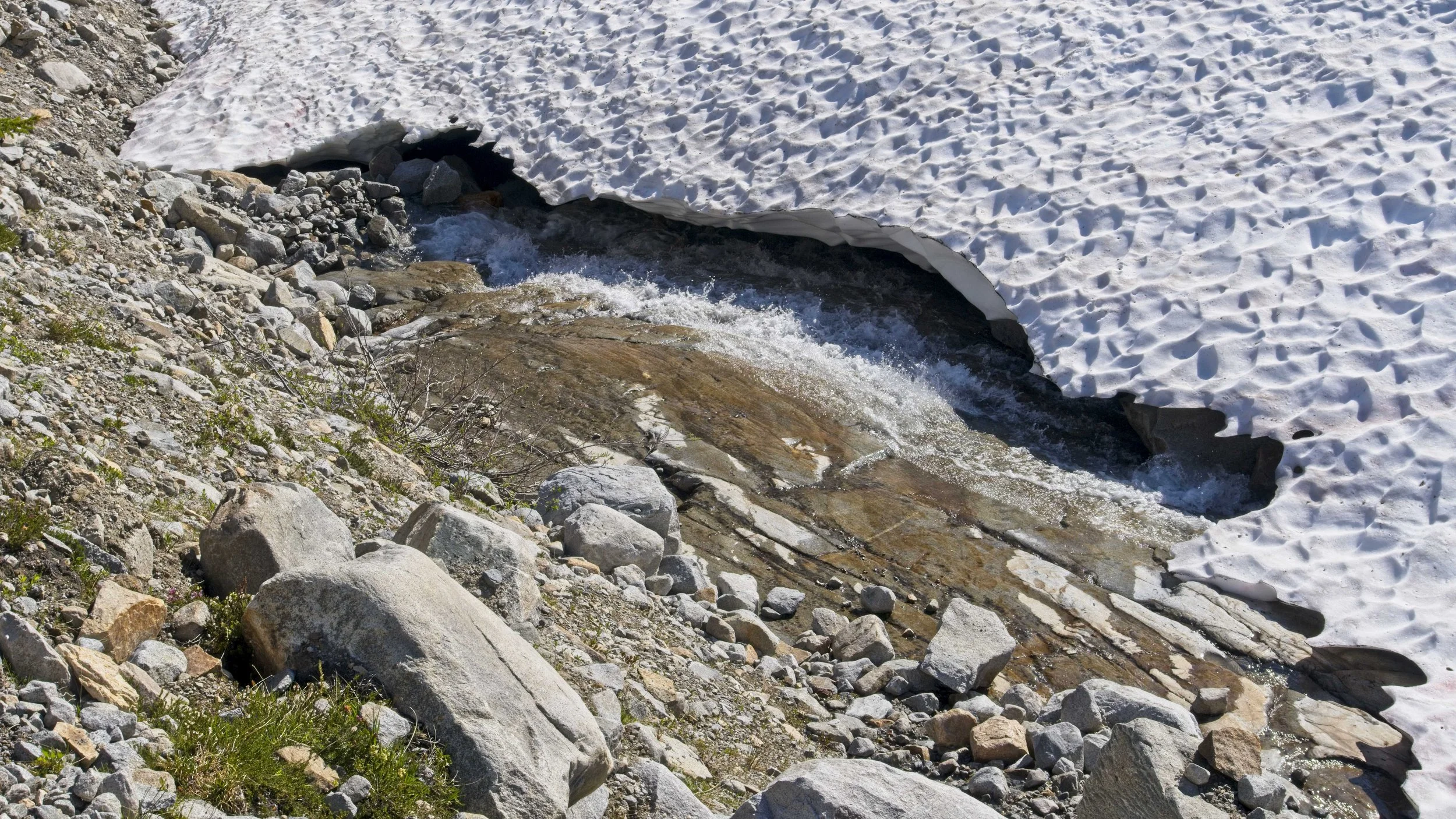
Part of my B-line was a long snow field crossing and twice my leg punched right through the snow and fell one or two feet to the rocks underneath. I kept perfecting how to gauge more stable paths in the snow and got to the edge of the little plateau where Tank Lakes resided. It was a long and painful descent with tons of boulder hopping. The Heat Dome’s relentless assault on the snowpack resulted in lots of swampy conditions in the valley. The trail would appear and then vanished under snow or swamp but I was in the right valley and heading in the right direction. I soon stumbled upon the Necklace Cabin, a shelter that looked like it was taken straight from the Appalachian Trail. Only it was in a little rougher condition. I passed a trio of girls who camped nearby after hearing that Tank Lakes were still completely socked in under tons of snow. I let them know that whoever told them that is a liar, I just camped there and it was completely thawed out and dry.
Jade Lake was also filled to the brim and the small stone walkway on the edge was now underwater. I just trudged right through, too exhausted to bother with taking my shoes off to keep dry. I thought I had made it to the flat valley where I’d be able to cruise to the finish line but I misjudged the topo map yet again. One more painfully steep decent littered with down trees was the final blow to my energy reserves. I knew that I probably would not make it to the trailhead by 2pm, which was the official “start to worry” time that Snaps (my ride) and I agreed upon. I took lunch at a log-bridge spanning the East Fork Foss River and a couple caught up and joined me. They were also aiming for Tank Lakes to camp last night but the ascent to Jade Lake proved to difficult so they stayed in the valley. The guy warned me that just ahead there is a long overgrown patch of stinging nettle weeds so I opted to wear my pants instead of Space Jam shorts. It was the right call.
Tip of Opal Lake.
Opal Lake.
Heavy snow took its toll on the trail, many downed trees.
After crossing the river, it was all flat trail with soft dirt tread and I was able to kick it into high gear. The calories from lunch and icing my aching knees in the frigid water really rejuvenated me. I felt like I was back on Endor flying past massive trees and lush forest floor. I passed a few campsites that looked very inviting and one had old mining tooling strewn about. I checked my maps and seemed to be about 1.5 miles from the finish and still had 18 minutes until 2pm. I ran out of water but kept trucking with a new determination to make it before the “worry time” cutoff. Two ladies passed me and said “You must be Grooman!” and added that the trailhead was no more than 100m away and that Snaps was waiting for me. I made it! 2PM ON THE DOT! I gave Snaps a huge sweaty hug, chugged an ice cold beer and a water, and laid down on the picnic table. I never thought this 22-mile loop over three days would’ve kicked my ass.
Sketchy log bridge over the East Fork Foss River.


Some mining remains littered about the numerous gorgeous campsites in Necklace Valley.
Root system of a big tree. My trekking poles are about 55” tall.
The couple from the bridge caught up and we shared a beer and chatted for a bit. Then Snaps whisked us up to Steven’s Pass to throw some trail magic for any PCT southbounders that happen to be passing by. There were none. So we just hung out, eating the provisions we brought for hikers and then left a bag of beers and goodies at the trail head. Snaps drove me back to the Seattle airport where I caught a redeye flight back to DC. I drove home, slept for about an hour and then had to go into the office on Monday.
In less than 24 hours I went from the isolated Tank Lakes in the Snoqualmie Wilderness, to a cubicle in an office over 3,600 miles away in Maryland. I knew right then that this cubicle life was not panning out as I had hoped and I wound up quitting than three months later.