

Section 11 is 121.1 miles long and runs from Highway 28 and right through the middle of the town of Rawlins, WY. August 21st - 25th.
Day 59, 17.2 miles to Sweetwater River
I woke up to someone playing some beautiful and calming music on a piano located outside the nearby rec room. Then an early morning jogger or two gave me the stank eye for having camped on the playground so I quickly got packed up and vacated. I admired some Southern Globethistles and ?? on my way back to town where I settled in for some brekkie and to begin editing my Dozen Dip Challenge movie. Unfortunately, my SD card failed. I tried not to freak out and spent the next few hours using a library computer and looking for a tech shop in town to try to recover my footage. I had no luck but knew I'd be hopping off trail in a week to go home for my cousin's wedding so I could work on it then. I ran into Fidget and Merlin at a vegan restaurant and joined them for lunch. We took care of town chores and soon a hitch fell into our laps so we took advantage of the opportunity. A few miles in, the trail crosses South Pass City, an old mining town that was preserved and is now a little tourist attraction. The General Store kindly hold packages for hikers and I had a new pair of shoes to pickup since my current pair had 780 miles of hiking on them. Merlin set out ahead of me as I talked to Sea Lion over WiFi (the entire state of Wyoming is a dead zone for cell service, for me at least) It was pretty much a flat and boring wasteland. Darkness fell, the trail became non-existent, and luckily there was a gravel road to use as an alt route. The moonlight was just bright enough to illuminate the smooth white gravel and you could hike as fast as you could without a headlamp. It was trippy to speed hike in a seemingly endless black void. I caught up to Merlin and we hiked a few more miles to make it to the bridge over Sweetwater River. As we were looking for camping spots, we checked underneath the bridge and foundation some trail magic!
City Park.

Prints Available!
Southern Globethistle.
Lander, WY.
The old Blacksmith shop.
Wagon Wheel bendy machine.
South Pass City.
Day 60, 31.1 miles to marker 1312.7
Although I can rig my sleep system on the ground, I was determined to hang it from the bridge which proved to be quite difficult. It was a concrete bridge without many good attachment points but I made it work and slept well until some noisy cows arrived for a morning drink. I enoyed brekkie in bed accompanied by one of the trail magic beers we found under the bridge the night before. We hit the trail which remained pretty flat and boring (theme of this entire section) but there were a few reliable springs along the way. The first one, Upper Mormon Spring, had a bunch of cows loitering around and we were briefly graced by the presence of a pack of wild horses. The next up, Weasel Spring, was a covered well so animals did not hang around and there were some boulders to sit against as we enjoyed lunch. We passed a ton of concrete sign posts for the Oregon Trail and the California Trail which mostly just confused us. Merlin caught a few horned lizards and the miles kept flying by as we crushed the flat terrain. He stopped to tape up a shin splint and I carried on to a water cache which was incredibly windy. I leaned against the fence, ate some dinner, and was totally caught off guard when Merlin arrived and immediately said he was quitting the CDT. His shin splint became unbearable and he had no desire to take a weeks-long break to let it heal. The cache was on a dirt road that led to Highway 287 where he could hitch into Rawlins. We said our goodbyes and I again hiked until darkness fell. I could not find any trees or structures to hang from or see anything promising on the topo maps (which show tree cover) so I decided to call it and sleep on the ground. I got my tarp and everything rigged up and soon after curling up in bed, a strong wind gust blew it all over. I was too tired to try again so I left my shelter on the ground, put my pack on top to weigh it down, rolled up my bedding, and cowboy camped next to a big sagebrush.
That cement footer on the right barely held onto my hammock strap.
California trail…WHAT?
Day 61, 28.1 miles to marker 1340.8
I begrudgingly packed up my fallen tarp and decided I would have to plan more carefully for the rest of my nights in the Great Basin. I was hoping to rock a bunch of 30’s but a water source in 28 miles apparently had a fence around it and I hoped it would suffice. I didn’t sleep very well on the ground and was pretty tired today as I dragged on. A few miles in there was a couple of trees that may have been hammockable but I would have been hiking well into the night to get here. I filtered some water from a trickling stream that had tons of cow prints all around. It was then some gentle uphill before some gentle downhill and a huge dark cloud began to chase me down. Thankfully it continued to move West while the trail hooked South and I escaped without a drop hitting me. I arrived at the clear and strong flowing spring feeding Crooks Creek that was overrun with cows but at least the spring was piped. I was temporarily pissed when I saw a beer can sitting under the pipe, thinking it was trash, but then I realized that a trail angel had placed a full Sierra Nevada there to keep it chilled by the fresh water! Score! I took a lunch break and enjoyed the suds as I realized this would be the fourth empty can I’d be carrying. Worth it. There was some more lengthy stretches of dirt road walking across the flat landscape but I saw some small herds of pronghorns along the way. I arrived at the water source and was elated to see there was a neighboring pen with a strong fence to keep the cows away from the electronics that operated the well pump. It was the perfect size to hang my hammock and was completely free of cow pies! Seabiscuit and Ricky Bobby caught up and we all ate dinner inside the pen as we watched a pretty great sunset.
Pronghorn.
Menacing cows.
Day 62, 34 miles to marker 1374.8
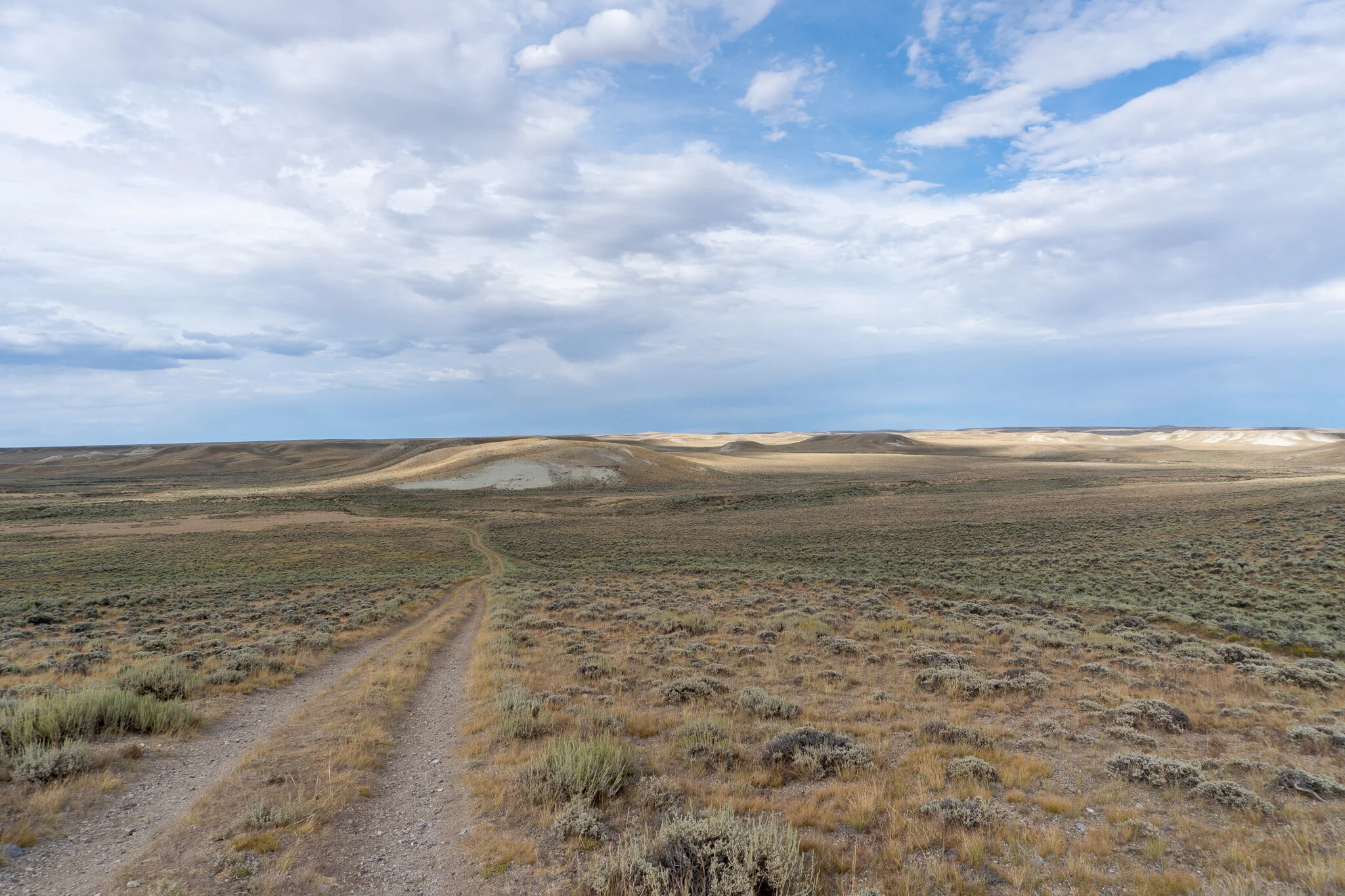
Today was literally entirely downhill and we crushed 34 miles in about 10 hours. The day was also defined by a nonstop road walk on a dirt track so it was another dull trek. The last notable feature of the day was there was only water sources at 16, 24, and 32 miles with the middle two having questionable map notes. I cameled up big time at camp before setting off and planned to skip Bull Springs at mile 16 because most comments said everything was covered in cow dung. Even the handle to open the well lid had poo on it. It was also said that the water had a terribly taste even after filtering it and adding Mio. I listened to a bunch of music to help pass the miles and keep my mind off of the heat. The past few days had a good bit of cloud cover which was a godsend because there are absolutely no shady trees to rest under. Not today, the sun was in full brightness. I caught up to Ricky Bobby at Bull Springs where he was filling up and I stopped for a lunch break and to filter my reserve water that I had been carrying since camp. I passed a cow skeleton that still had it’s face attached which was rather creepy and continued to blast some miles. I arrived at the pond, which looked like a construction site sediment pond, and took another food break as I filtered water. It tasted a little chalky but that was better than tasting a little shitty. Some more long straight trail and then it linked up to Highway 287. There was a gorgeous spring with clear and cold water after a few miles of hiking on the side of the highway and thankfully some new tread was maintained a few hundred yards away from the pavement. I caught up to Ricky Bobby and Seabiscuit at an established campsite in some trees where, allegedly, Dominos pizza would deliver to. Unfortunately, being Saturday evening, they were busy and refused to bring us some pies. This was devastating. We all begrudgingly cooked more of the same old camp food and went to bed early.
The endless road walks of the Great Basin.
Another Pronghorn.
Copy-Paste mountains.
Day 63, 10.7 miles to Rawlins, WY
We all left around the same time but wound up taking slightly different routes. Seabiscuit went back to the highway to roadwalk the straightest line possible to town. Ricky Bobby stayed on the official trail which zigzagged around and often became faint and hard to follow. I kind of bushwhacked my own trail in a somewhat straight path. There was a mining operation on the other side of a small berm and worth the 0.1 mile off trail trek to check out. I snapped some photos and when I got back on the CDT, Ricky Bobby caught up and decided to go check out the miners as well. I got to town and was planning to grab a free shower at the Rec Center and then camp at the fairgrounds. The Rec Center is closed on Sundays so I walked down to Econolodge to see if I could convince RB and SB to let me split their room. We caught up with Merlin who had been resting in town the past two days and found a ride to Denver today. We said our goodbyes, got checked into our room, and then Ricky Bobby and I went to the neighboring Pizza Hut to indulge in their buffet. But Pizza Hut was also closed. I was hating this town! No Domino's, no rec center, no pizza buffet. We instead walked to Burger King to try their impossible burger which tasted pretty much just like a regular BK burger. The rest of the day was spent relaxing at the pool, doing laundry at the hotel, getting snacks at the grocery store, and lots of laying around watching crappy movies on TV.

Don’t forget to smile.
Finally made it! Phase 1 complete, now for a vacation from the trail.